Map 2 - Skirwith Abbey, Culgaith Water and Lower Winderwath, River Eden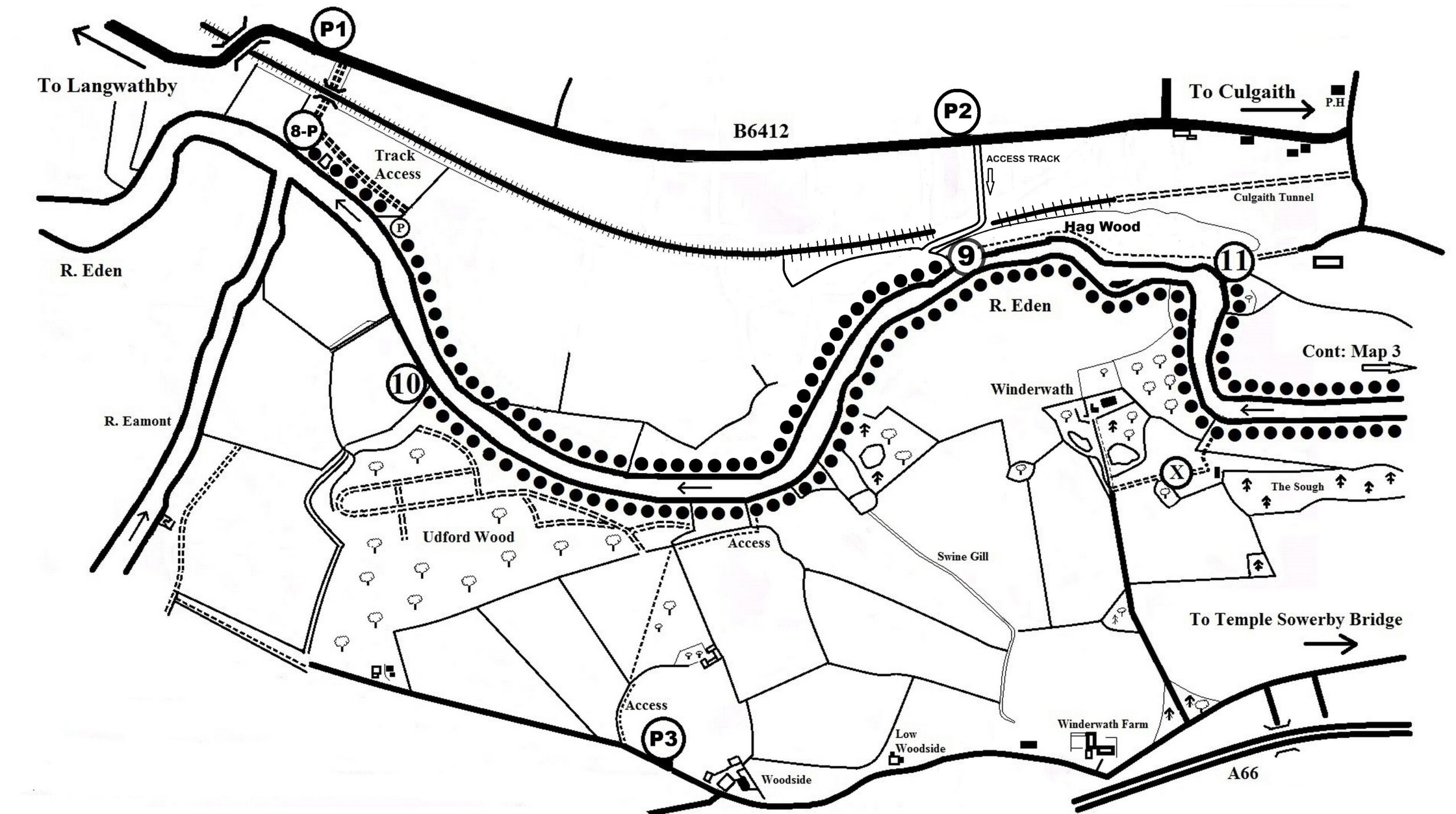
Skirwith Abbey (1250 yds) (Winter Grayling Fishing Allowed)
P1 (What3words - duties.terms.scorch): From Junction 40 (M6) take A66 to the next roundabout, then take the 2nd exit (A686 Alston). Follow this road to Langwathby, continue through the village and take the first turn on the right towards Culgaith on the B6412. Travel 1.9 miles over the railway bridge and park on left verge approx. opposite the track that goes down and under the railway. Suitable vehicles (4x4) can park down the dirt track at P (What3words - basics.beeline.spacing), but it is not recommended in wet conditions. (PLEASE DO NOT OBSTRUCT THE TRACK)
Culgaith Water (approx. 975 yds) (Winter Grayling Fishing Allowed)
P2 (What3words – grips.identify.districts): From Junction 40 (M6) take the A66 to the next roundabout, then take the 2nd exit (A686 Alston). Follow this road to Langwathby, continue through the village and take the first turn on the right towards Culgaith on the B6412. Travel approximately 2.8 miles and park on the grass verge on the right, there are two gates, the second one is the lane to the river, signposted 'Public Footpath Pea Foot', follow the lane on foot to the bottom (do not attempt to drive down the lane) and on entering the field turn left and follow the fence to the river. PLEASE NOTE: When parking do not block any gates and please be aware that this can be a busy road at times. When you reach the bottom of the lane do not wander across the farmer's field to the river (follow guidance mentioned above) and please make sure that any gates that you open are securely closed behind you.
Lower Winderwath (3360 yds) (Grayling only from *16th June to 30th Oct)
P3 (What3words - curiosity.duties.heartburn): From Junction 40 (M6) take the A66 to the next roundabout, then take the 3rd exit (A66 Brough / Scotch Corner), travel 3.4 miles and turn left for Hornby Hall. Then take the first right and continue down to the T junction (cottage opposite), turn left at the junction, then drive for approx. 150 yds and park on the right at P3 on grass verge signed PAA and then follow the route (shown on map) down to the river.